Always getting lost in the 6ix? Crack the code of Toronto's streets.
Prompted by NerdSip Explorer #5918
Master the GTA map and navigate Toronto like a local.
If you’ve ever looked at a map of Toronto and felt completely overwhelmed, you aren't alone! Let’s start with the big picture: the Greater Toronto Area (or the GTA for short).
Think of the GTA like a giant fried egg. The rich, incredibly dense yolk right in the middle is the City of Toronto itself. The egg white spreading out around it is made up of four large, surrounding regional municipalities.
Moving roughly from West to East, these four regions are Halton, Peel, York (which sits just North of the city), and Durham. Together, they form one massive, seamlessly connected urban landscape that is home to over six million people!
So, when someone casually says they live or work in "the GTA," they might mean they are right downtown near the CN Tower, or they might be in a sprawling, quiet suburb an hour's drive away. Understanding these five pillars is your first step to mastering the map!
Key Takeaway
The Greater Toronto Area (GTA) consists of the City of Toronto surrounded by four regions: Halton, Peel, York, and Durham.
Test Your Knowledge
Which of the following is NOT a region in the Greater Toronto Area (GTA)?
Getting around Toronto is so much easier once you realize that it’s essentially built like a giant checkerboard.
Back in the late 1700s, early British land surveyors mapped out the area using a rigid grid system. They laid out major roads (historically called "concession roads") in straight lines, running either completely North-to-South or East-to-West.
Today, these major concession roads act as the city's main "arteries." Because they are mostly parallel or perpendicular to each other, it's actually very hard to get completely lost. If you walk far enough in one direction, you will almost always hit a major, straight street that will help you find your bearings.
Inside these large grid squares are the smaller, curvier neighbourhood streets, often filled with houses, parks, and cul-de-sacs. So, if you ever feel turned around, just remember the golden rule of Toronto geography: the major roads mean straight lines, and the smaller roads mean local, winding neighbourhoods!
Key Takeaway
Toronto's major streets are laid out in a straight, perpendicular grid, making it relatively easy to navigate.
Test Your Knowledge
How are Toronto's major roads primarily laid out?
If the sprawling city of Toronto had a spine, it would undoubtedly be Yonge Street (pronounced exactly like the word "Young").
Yonge Street runs straight up the middle of the city, starting right at the edge of Lake Ontario and heading dead North for miles. But it’s not just a busy, vibrant road filled with shops and restaurants—it is the city’s official geographic equator.
Yonge Street perfectly divides Toronto into East and West. Every single major street that crosses Yonge gets split into two distinct halves. For example, when Queen Street crosses Yonge, it officially becomes "Queen Street East" and "Queen Street West."
Even better? Building numbers always start at zero at Yonge Street and count upward as you move further away. If you are standing at 100 Queen Street West, and your friend is at 400 Queen Street West, you instantly know you just need to walk further West, away from Yonge! It makes finding addresses incredibly predictable.
Key Takeaway
Yonge Street divides Toronto into East and West, and building address numbers start at zero on either side of it.
Test Your Knowledge
If you are walking on an East-West street, what happens to the building numbers as you walk further away from Yonge Street?
Aside from the famous Yonge Street, Toronto has a handful of iconic, bustling roads that you absolutely need to know.
Running East-to-West, you have a layered cake of major streets. Near the lake, you will find King Street and Queen Street, both famous for their trendy shopping, incredible food scenes, and iconic red streetcars. Further North is Dundas Street, and above that is Bloor Street, a massive road that forms the backbone of Toronto's primary East-West subway line.
Running North-to-South, running parallel to Yonge, you'll find University Avenue (a grand, wide boulevard home to the city's major hospitals) and Spadina Avenue, known for its bustling Chinatown and dedicated streetcar lanes.
When these major streets cross each other, they form massive hubs of urban activity. For example, the intersection of Yonge and Dundas is famously known as the "Times Square of Toronto," filled with bright billboards, street performers, and endless crowds!
Key Takeaway
Major East-West roads include King, Queen, Dundas, and Bloor, while University and Spadina are key North-South routes.
Test Your Knowledge
Which major street features Toronto's primary East-West subway line?
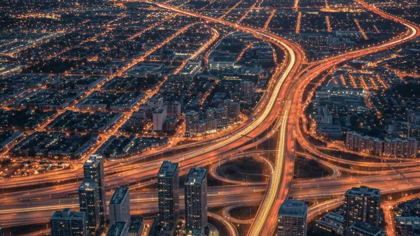
To truly understand the geography of the GTA, you have to understand its massive highways. Think of them as concrete rivers moving hundreds of thousands of cars every single day.
The undisputed king of them all is Highway 401. It runs horizontally across the top half of the city. It is famously one of the busiest and widest highways in the entire world, acting as the main, high-speed bridge between the eastern and western suburbs.
If you need to get directly downtown, you have two main options. On the East side, you can use the Don Valley Parkway (DVP), which winds beautifully through a lush, green ravine. On the South edge, tightly hugging the waterfront, is the Gardiner Expressway, which carries cars right past the towering base of the CN Tower.
Together, the 401, the DVP, and the Gardiner form a giant triangle around the city's core, helping commuters zip across the expansive GTA!
Key Takeaway
Highway 401 runs horizontally across the city, while the DVP and Gardiner Expressway funnel traffic directly into the downtown core.
Test Your Knowledge
Which highway runs directly along the southern edge of Toronto, tightly hugging the waterfront?
Track your progress, earn XP, and compete on leaderboards. Download NerdSip to start learning.